Why the Ring Road
Iceland's Route 1 — the Ring Road — is a 1,322-kilometre loop that circles the entire island, connecting every major region from Reykjavik's urban energy to the silent emptiness of the East Fjords. It is, without exaggeration, one of the greatest road trips on Earth. Not because of any single landmark, but because of the relentless variety: in seven days you will drive past erupting geysers, walk behind waterfalls, hike on glaciers, stand on black sand beaches with basalt sea stacks, soak in geothermal pools carved into lava fields, and watch humpback whales breach in fjords where no other car has passed for an hour.
Seven days is the minimum to do the Ring Road properly. You can technically drive the loop in under 20 hours, but that would mean skipping everything worth stopping for. With seven days, you get roughly 3-4 hours of driving per day and 4-6 hours of exploring — enough to experience each region without the trip becoming an endurance rally. Eight or nine days is more comfortable, but seven is the sweet spot for most travellers taking a week off work.
The road itself is almost entirely paved two-lane highway. You do not need a 4WD for the Ring Road in summer (though you will need one if you detour onto any F-roads). A standard rental car is fine from June through August. The driving is straightforward — the challenge is not the road, it is resisting the urge to stop every ten minutes because the landscape keeps changing so dramatically.
Compare rental prices from all major providers in Reykjavik — 4x4s essential for highlands, standard cars fine for Route 1 in summer.
Compare Car Rentals →Day 1: Reykjavik + Golden Circle
Pick up your rental car at Keflavik Airport or in Reykjavik early in the morning. If your flight arrives the night before, spend the evening walking Reykjavik's compact downtown — Laugavegur shopping street, Hallgrimskirkja church for the tower view, and dinner at one of the harbour restaurants. But the Golden Circle is where the trip truly begins.
Thingvellir National Park is a 45-minute drive from Reykjavik and your first stop. This is where the Eurasian and North American tectonic plates pull apart — you can literally walk in the rift valley between two continents. Beyond the geology, Thingvellir is where Iceland's parliament, the Althing, was founded in 930 AD, making it one of the oldest parliamentary sites in the world. Park at the main visitor centre (P1) and walk down into the Almannagja gorge. The path to Oxararfoss waterfall takes about 20 minutes and is well worth it. If you have a dry suit certification, Silfra fissure offers snorkelling in glacial water with 100-metre visibility — book in advance through a licensed operator.
Geysir geothermal area is 50 minutes further east. The original Great Geysir is mostly dormant now, but its neighbour Strokkur erupts faithfully every 5-10 minutes, shooting a column of boiling water 15-25 metres into the air. Stand upwind and watch for two or three eruptions — the anticipation of the water dome bulging before it blows is genuinely thrilling every time. The surrounding mud pots and fumaroles are worth exploring for another 20 minutes.
Gullfoss waterfall is ten minutes up the road and arguably Iceland's most powerful waterfall. The Hvita river drops in two stages into a 32-metre canyon, and on a sunny day the spray creates permanent rainbows. Walk down both viewing platforms — the upper one gives you the panoramic context, the lower one puts you close enough to feel the ground shake. In summer, the volume is immense.
Where to stay: Drive to Selfoss or Hella (about 1 hour from Gullfoss) to position yourself for the South Coast the next morning. Both towns have good guesthouses and hotels and petrol stations.
Day 2: South Coast
This is the day that makes people fall in love with Iceland. The South Coast packs more iconic sights into a 180-kilometre stretch than most countries manage in their entirety.
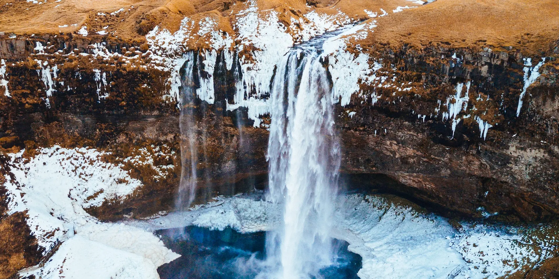
Seljalandsfoss is your first stop, visible from the road as a slender 60-metre waterfall dropping off a cliff. What makes it special: you can walk behind it. A path loops around the back of the falls through a shallow cave, putting you inside the curtain of water with the green farmland beyond. Wear a waterproof jacket — you will get soaked. Bring a lens cloth if you are photographing. Just 500 metres south, the hidden waterfall Gljufrabui is tucked inside a narrow canyon. Wade through a shallow stream to reach it — far fewer tourists, and the enclosed canyon amplifies the roar.
Skogafoss is 30 minutes further east and the South Coast's heavyweight. Sixty metres tall and 25 metres wide, it hits the ground with enough force to generate a permanent mist cloud. Climb the 527 steps on the eastern staircase to the top for a view along the Skoga river — from up there, you can see the Fimmvorduhals hiking trail stretching toward the glaciers. If you are here on a sunny morning, expect a double rainbow in the spray.
Reynisfjara black sand beach is the day's climax. The beach is jet black — volcanic sand ground from basalt over millennia. Hexagonal basalt columns rise in a wall at the back of the beach like an organic pipe organ. The Reynisdrangar sea stacks — three jagged rock pillars — stand just offshore. The waves here are genuinely dangerous: sneaker waves surge up the beach with no warning and have killed visitors. Stay well back from the waterline, never turn your back on the ocean, and do not walk to the water's edge for a photo. The beach is spectacular from 30 metres back.
Stop briefly at Dyrholaey, a dramatic rock arch and promontory just west of Reynisfjara. In summer, Atlantic puffins nest in the cliffs here — hundreds of them. The lighthouse at the top gives you a panoramic view of the entire South Coast, from Myrdalsjokull glacier to the black sand stretching east.
Where to stay: Vik, the southernmost village in Iceland. Small but well-equipped with restaurants, a supermarket, and several guesthouses. Book accommodation ahead in summer — Vik has limited rooms for the volume of Ring Road traffic.

Vik, Selfoss, and Hella fill up fast in summer. Compare prices from dozens of guesthouses and hotels along the South Coast.
Day 3: Glacier Lagoon
Today's drive from Vik to Jokulsarlon is about 2.5 hours, but the landscape between them — vast black sand deserts called sandur, framed by glaciers tumbling down from Vatnajokull ice cap — makes even the driving feel like sightseeing.
Jokulsarlon glacier lagoon is Iceland's most otherworldly sight. Icebergs calved from Breidamerkurjokull glacier float slowly across a deep lagoon, ranging from house-sized blocks to car-sized chunks, some streaked blue, others white, a few stained with volcanic ash in black stripes. Seals swim between the bergs. The lagoon is silent except for the occasional crack and splash of ice breaking. You can spend an hour here just watching from the shore, or book an amphibian boat tour or zodiac tour to get among the icebergs. The zodiac tours run in summer and get you much closer — they are worth the premium.
Diamond Beach is directly across the road from the lagoon, where the river carries smaller icebergs to the ocean. They wash up on the black sand and sit there glinting in the sunlight like enormous jewels — translucent, blue-white, slowly melting. This is one of the most photographed locations in Iceland and it is even more striking in person. Walk the beach in both directions; the ice distribution changes constantly.
In the afternoon, drive back 30 minutes to Skaftafell, a green oasis within Vatnajokull National Park. The Svartifoss waterfall hike (3.2 km return, about 1.5 hours) takes you to a waterfall framed by hanging basalt columns — the same geological formation as Reynisfjara but suspended overhead. If you want a glacier experience, several operators run guided glacier walks on Svinafellsjokull or Falljokull from the Skaftafell visitor centre. No prior experience needed — they provide crampons and ice axes and teach you as you go. A 3-hour glacier walk is one of the most memorable things you can do in Iceland.
Where to stay: Continue east to Hofn (about 1.5 hours from Jokulsarlon). Hofn is the lobster capital of Iceland — the langoustine here is superb. Several hotels and guesthouses, and it is a good-sized town with fuel and supplies.

Glacier hikes, ice cave tours, boat rides on Jokulsarlon, and Golden Circle day trips — book with free cancellation.
Browse Iceland Activities →Day 4: East Fjords
The East Fjords are the Ring Road's quiet chapter. After three days of blockbuster waterfalls and glacier lagoons, today is about solitude, winding coastal roads, and fjords so empty you might not see another car for 20 minutes at a stretch.
The drive from Hofn to Egilsstadir is about 250 kilometres and takes 3-4 hours without stops, but you should stop often. The road hugs the coastline, cutting in and out of narrow fjords — Berufjordur, Stodvarfjordur, Reydarfjordur, Faskrudsfjordur — each one framed by steep mountains dropping straight to the sea. The light in the East Fjords is different from the rest of Iceland: softer, more atmospheric, with low clouds drifting through the valleys.
Stop at Stodvarfjordur to visit Petra's Stone Collection, a private museum of minerals and gemstones gathered over a lifetime by local resident Petra Sveinsdottir. The garden alone, filled with thousands of polished stones and crystals, is unlike anything you will see elsewhere in Iceland.
If you have time, detour to Seydisfjordur, a 25-kilometre side road from Egilsstadir that winds over a mountain pass and drops into one of Iceland's most charming towns. Seydisfjordur is famous for its rainbow-painted road leading to a blue church, its thriving arts scene, and its position at the head of a stunning fjord. The Smalandsvatn ferry terminal here connects Iceland to the Faroe Islands and Denmark. The town has good coffee shops, a craft brewery, and the kind of quiet beauty that makes you consider extending your trip.
Where to stay: Egilsstadir, the largest town in East Iceland. It sits on the shore of Lagarfljot, a long narrow lake that locals claim houses a serpent-like creature (Iceland's Loch Ness). Solid hotel options and a well-stocked supermarket for restocking road snacks.
Day 5: North Iceland
North Iceland packs the Ring Road's most diverse experiences into a single day. You will see Europe's most powerful waterfall, bathe in a geothermal lake, stand at a waterfall the Vikings named, and optionally watch whales in one of the world's best cetacean habitats.
From Egilsstadir, drive north and then west toward the Myvatn area (about 2.5 hours). If you detour 30 minutes off the Ring Road, you can reach Dettifoss, the most powerful waterfall in Europe by volume. The Jokulsa a Fjollum river drops 44 metres over a 100-metre-wide ledge with a thunderous roar you can hear before you see it. Approach from the east side (Route 864, which is now paved) for the best viewing platforms. The spray from Dettifoss is visible from kilometres away. Stand at the canyon rim and watch the grey glacial water — loaded with sediment from Vatnajokull — pour over the edge with terrifying force. Nearby Selfoss (upstream, 1.5 km walk) is a wider, lower cascade that is beautiful in a completely different way.
Myvatn Nature Baths should be your next stop. Skip the Blue Lagoon near Reykjavik — it is overcrowded, overpriced, and over-instagrammed. The Myvatn Nature Baths are the same concept (a geothermally heated milky-blue lagoon) but with a fraction of the visitors, lower prices, and views over the Myvatn volcanic landscape. The water is rich in minerals and stays at 36-40 degrees Celsius year-round. Soak for an hour and let the previous four days of driving dissolve.
The Myvatn area itself is a volcanic wonderland worth exploring: the Hverir geothermal field (bubbling mud pots and steam vents), the Grjotagja cave (a lava cave with a hot spring inside — swimming is no longer allowed but you can look), and the Dimmuborgir lava formations (a labyrinth of lava pillars and arches).
Godafoss — the Waterfall of the Gods — is 35 minutes west of Myvatn on the Ring Road. It is 12 metres tall and 30 metres wide, splitting around a central island of rock. The name comes from 1000 AD, when the lawspeaker Thorgeir threw his Norse god idols over the falls after Iceland officially converted to Christianity. It is one of Iceland's most photogenic waterfalls — the wide horseshoe shape photographs beautifully from both sides.
For whale watching, detour 45 minutes north from Myvatn to Husavik, widely considered the whale-watching capital of Europe. Humpback whales, minke whales, and occasionally blue whales feed in Skjalfandi Bay from May through September. Success rates on summer tours exceed 95%. Several operators run 3-hour tours from the harbour. Book a morning departure to keep your afternoon schedule flexible.
Where to stay: Akureyri, the capital of North Iceland (population 19,000). It sits at the head of Eyjafjordur and has genuinely good restaurants, Iceland's only botanical garden, and an excellent swimming pool. Akureyri feels like a small city after days of remote guesthouses.
Day 6: Northwest to Snaefellsnes
Today is the longest driving day — about 4-5 hours from Akureyri to the Snaefellsnes Peninsula — but the route through the north and west offers landscapes you will not see anywhere else on the Ring Road.
Drive west from Akureyri through Skagafjordur, a broad valley famous for Icelandic horse breeding. If you have time for a one-hour horseback ride through the valley, several farms offer short trail rides — Icelandic horses are small, sure-footed, and famously gentle. The breed has been isolated on the island for over 1,000 years and has a unique fifth gait called the tolt, a smooth running walk that feels like gliding.
Continue west through the Hrutafjordur valley and south toward the Snaefellsnes Peninsula. As you approach from the east, Snaefellsjokull glacier-volcano begins to dominate the western horizon. Jules Verne chose this volcano as the entrance to the centre of the Earth in his 1864 novel — and when you see its symmetrical ice-capped cone rising from the coastline, you understand why.
Kirkjufell is the most photographed mountain in Iceland and the visual highlight of Snaefellsnes. The 463-metre peak has a distinctive cone shape, and when photographed from the Kirkjufellsfoss waterfalls just across the road, the composition — waterfall foreground, cone mountain, sky — is the definition of iconic. Kirkjufell appeared in Game of Thrones as "the mountain shaped like an arrowhead" north of the Wall. Visit in the evening when the tour buses have left and the golden-hour light wraps around the mountain's western face.
Drive the coastal road west to Arnarstapi, a tiny harbour village on the south coast of the peninsula. A marked coastal walking path runs 2.5 kilometres from Arnarstapi to the neighbouring hamlet of Hellnar along dramatic sea cliffs. The cliffs are riddled with natural arches, blowholes, and bird-nesting ledges — Arctic terns, fulmars, and kittiwakes. The Gatklettur stone arch over the sea is a highlight. The walk takes about 40 minutes one way and is flat and easy.
Where to stay: Grundarfjordur (near Kirkjufell) or Stykkisholmur, a picturesque harbour town with colourful houses stacked on a hill above a sheltered bay. Stykkisholmur has good restaurants and the Volcano Museum if you want to understand Iceland's geological engine.
Day 7: Snaefellsnes + Return to Reykjavik
Your final morning on the Snaefellsnes Peninsula. Use it well — this region is often called "Iceland in miniature" because it concentrates glaciers, lava fields, volcanic craters, sea cliffs, and golden beaches into a single 90-kilometre peninsula.
If the weather is clear, drive up toward Snaefellsjokull glacier on the mountain roads (accessible in summer without 4WD as far as the lower car parks). The glacier sits at 1,446 metres and on a clear day the views from the approaches extend across the entire peninsula and out to the Westfjords. Guided glacier summit tours are available from Arnarstapi — a full-day commitment, so only consider this if you have an evening flight.
Budakirkja — the black church of Budir — is one of Iceland's most solitary and photogenic buildings. A small jet-black wooden church sitting alone in a lava field, with the glacier behind it and the ocean in front. It dates to the 19th century (a church has stood on this site since the 17th) and is still used for weddings. The surrounding Budahraun lava field is carpeted in moss and wildflowers in summer. Spend 20 minutes here in silence; it is one of those places that earns the word "atmospheric."
The drive from Snaefellsnes back to Reykjavik takes about 2.5 hours via Route 54 and Route 1. If you are flying out today, the Blue Lagoon is located between Reykjavik and Keflavik Airport — a logical final stop. Pre-booking is mandatory and slots fill up weeks in advance, so reserve during your trip planning. Despite the crowds, the experience is genuine: the milky-blue geothermal water in the black lava field, the silica mud mask, and a cold drink at the in-water bar make a fitting farewell. Alternatively, the newer Sky Lagoon near Reykjavik offers a similar experience with ocean views and shorter queues.
If you are staying another night in Reykjavik, use the evening for anything you missed on Day 1 — the Harpa concert hall's glass facade at sunset, the Sun Voyager sculpture on the waterfront, or a final lamb soup at Svarta Kaffid (served in a bread bowl).
When to Drive the Ring Road
The Ring Road is drivable year-round, but the experience varies dramatically by season. Here is what each window offers:
Summer (June to August) is the recommended window for first-time Ring Road drivers. Days are effectively endless — Iceland gets 20-24 hours of daylight in June and July, meaning you can start driving at 7am and still be exploring at 11pm in golden-hour light. All roads are open, all mountain tracks are accessible, all accommodation is operating, and all activity operators are running full schedules. The downside is price: summer rental cars, accommodation, and activities cost 30-50% more than shoulder season. Book everything at least 2-3 months in advance.
Shoulder season (May and September) is excellent for experienced self-drivers who want lower prices and thinner crowds. In May, roads are mostly clear but some highland tracks may still be closed by snow. In September, the first Northern Lights of the season appear, autumn colours tinge the landscape, and prices drop significantly. Daylight is still generous (15-18 hours). The risk: weather is less predictable, and some smaller guesthouses and tour operators close for the season in late September.
Winter (October to April) transforms Iceland into a Northern Lights destination, but the Ring Road becomes genuinely dangerous. Daylight drops to 4-6 hours in December. Roads can be closed without notice due to blizzards, ice, and avalanche risk — especially in the East Fjords and north. F-roads are completely impassable. A 4WD with studded tyres is mandatory, and even then, sections of the Ring Road may be closed for days. If you want Northern Lights, do a South Coast-only trip from Reykjavik rather than attempting the full loop in winter.
Essential Driving Tips
- F-roads require 4WD: Any road beginning with "F" (e.g., F35 Kjolur, F26 Sprengisandur) is a highland track requiring a 4WD vehicle. Driving a 2WD on an F-road voids your rental insurance and is illegal. The Ring Road itself (Route 1) does not require 4WD in summer.
- Single-lane bridges: You will encounter many one-lane bridges, especially in the east and north. The car closest to the bridge has right of way. Slow down, check for oncoming traffic, and yield if someone is already on the bridge.
- Fuel stops: Plan your fuel stops. In the south and west, stations are frequent. In the East Fjords and north, gaps between stations can reach 150-200 km. Never let your tank drop below half in remote areas. N1 and Orkan are the most common fuel brands; all accept credit cards at self-service pumps (you will need your card's PIN).
- Wind warnings: Iceland's wind is no joke. Gusts regularly exceed 80 km/h and can reach 150+ km/h in storms. Hold your car door firmly when opening it — wind-damaged doors are the number one rental car insurance claim in Iceland. Check vedur.is (Icelandic Met Office) and road.is (road conditions) every morning before driving.
- Rental insurance: Standard CDW (collision damage waiver) does not cover sand, ash, or gravel damage in Iceland. Buy SAAP (sand and ash protection) and GP (gravel protection) — volcanic sand storms can sandblast your rental's paint in minutes. Windshield coverage is also recommended.
- Speed limits: 90 km/h on paved rural roads, 80 km/h on gravel roads, 50 km/h in towns (30 km/h in residential areas). Speed cameras are common and fines are steep — 30,000 ISK+ (roughly $220 USD).
- Off-road driving is illegal: Never drive off marked roads or tracks. Iceland's fragile moss and vegetation takes decades to recover from tyre damage. Fines are severe and enforced.
- Sheep on roads: From June to September, Icelandic sheep roam freely across the countryside, including on and beside the Ring Road. They are unpredictable and will dart across the road without warning. Slow down whenever you see sheep near the road, especially lambs — where there is one lamb, the mother is about to cross.

Photo Spots — Three Unmissable Frames
-
1Kirkjufell at Golden HourThe classic composition frames Kirkjufell mountain through the Kirkjufellsfoss waterfalls in the foreground. Set up on the viewing platform across the road from the mountain, shooting north-northwest. In summer, the sun barely sets, so "golden hour" stretches for hours in the evening. The mountain's conical shape catches warm light on its western face while the falls add motion and depth. Use a wide-angle lens (16-24mm) to get both falls and mountain peak in frame, and a slow shutter (1-2 seconds with ND filter) to smooth the water.Best time: 9pm-midnight in June-July. Arrive by 8pm to secure your tripod position. The car park is 50m from the falls.
-
2Diamond Beach — Ice on Black SandChunks of glacier ice, polished smooth and glowing blue-white, scattered across jet-black volcanic sand. The contrast is extraordinary in any light, but the best shots come when low sun backlights the ice, turning each piece into a lantern. Walk east along the beach for fewer people and larger ice pieces. Shoot low — getting your camera at sand level with ice in the foreground and the ocean behind creates the most dramatic perspective. Each wave rearranges the ice, so return throughout the day for entirely different compositions.Best time: Morning or evening light. Overcast days give the ice a deeper blue. Watch for waves — never turn your back to the ocean.
-
3Reynisfjara Basalt Columns with WavesThe hexagonal basalt column wall at the back of Reynisfjara black sand beach is a geological marvel — perfectly geometric columns rising 20+ metres, as if carved by a mason rather than cooling lava. Frame the columns with the cave opening to the west and the Reynisdrangar sea stacks visible through the surf. When waves crash onto the black sand, the white foam against the dark stone and geometric columns creates a study in contrast and texture. Include a person for scale — the columns dwarf everything.Best time: Afternoon light reaches the columns. Keep a safe distance from the waterline — sneaker waves are lethal here.
Everything you need for 7 days on the Ring Road — flights, car rental, hotels, and activities.
Ready to plan your Iceland trip?
Tell Tripva your travel dates, interests, and pace — and we'll build a complete day-by-day Ring Road itinerary with accommodation recommendations, driving distances, and booking tips. Takes 30 seconds.
Plan Your Iceland Trip ✦